Southern Tier Part 2 - Day #2 Perkinston, MS to Franklinton, LA
Southern Tier Part 2 - Day #2
The last place that I had stayed on part one of the Southern Tier tour was on Dauphin Island in Alabama. This made last night my first and only night in Mississippi. It was a rough night and I didn’t sleep very well. The storm rolled in around 11 PM as I was trying to upload images to yesterday’s report. It got windy and rain drops began spraying the picnic table where I was working. I quickly protected my things and retired to my tent. I had forgotten to zip up the tent after I had set it up, and a toad had wandered inside. When first erecting my tent, I wasn’t sure whether to set up the fly. It was warm and humid. I figured that if the storm was bad, the rain would blow in from the side. So I was cautious and installed the fly, which was a good decision. The rat-tat-tat sound of the rain hitting the tin roof above me made a nice sound. Then it became barrage of hard pelts. And then the thunder claps began. There were immense flashes of lightning followed by roaring booms of thunder. My main concern was a tornado. I was exposed on three sides with a large overhang structure above me. The slamming thunder startled me, and I could feel the ground vibrating beneath me. If things got bad, my plan was to go inside the building alongside the laundry machines and bathrooms.
The thunder eventually subsided but it kept raining. Somehow I eventually fell asleep. I wasn’t comfortable on the cement slab. My air mattress lost pressure as well as my pillow. I got cold in the middle of the night and pulled out my sleeping bag to use as a blanket. I was enveloped within my silk sleeping bag liner and was too tired to unzip the sleeping bag. At about 5 AM I finally opened the zipper. I had all sorts of weird dreams which is how I knew that I slept. This morning it was a slow pack-up. I heard a bob white chiming it’s call while rolling up my wet tent. Water had collected on my panniers. I had somehow forgotten to pack my cycling shorts and they had been blown halfway across the porch. It was 60° and I felt chilly. In addition to my cycling jersey and shorts, I put on my leg warmers and Legnano Pirelli cycling sweater. I washed my face with warm water and filled my water bottle before I headed out. There had been an outlet under the canopy and all of my devices were fully charged.
There were pools of water in the grass, and the stream that ran alongside the RV park was overflowing with brown muddy water. I took a left and continued onto Ten Mile Road. I then took a left on Perkinston Silver Run Road. It was gray and humid, and I had made the right clothing choice. I didn’t need the socks but my core and legs needed to stay warm. The road surface was wet. I had a four inch shoulder and rode to the left of the white line. There was very little motor traffic.
There were large cleared areas alongside the road. I noticed logging trucks and put the two together. By 9 AM the clouds were begining to slowly dissipate. Occasionally a Sunbeam would reach the ground. I cycled by the water tower and ostensibly the highest point in Stone County. Afterwards I enjoyed a nice downhill. I came to an intersection and took a left onto McNeil-McHenry Road. I noticed numerous signs saying ‘No dumping by order of the sheriff’. I saw the usual roadside soda cans and fast food trash, but not much else.
In Silver Run I took a right onto Silver Run Road and crossed into Pearl River County. At 9:15 AM it was still gray and cloudy. I passed an armadillo roadkill on the shoulder. At the intersection of Charles Toney Road I stopped to flip my paper map panels. I passed a large cactus bush in someone’s front yard, just as a dog ran out onto the road. I was caught off guard, but he didn’t give me much of a chase. I passed a series of signs saying that ‘Jesus is coming again’. A little dog chased me out onto the road and gave me a good run. I was a little concerned because I was wearing sandals.
I passed a large cow pasture to my left as the sun, once again, tried to pierce the gray clouds. There was blue sky to the west. I crossed over interstate 59 and took a right onto State Highway 53 into Poplarville. There was considerably more traffic and I had about 14 inches to the right of the white line.
I try to support local businesses and stopped at the delightful ‘Snowflake Donut and Taco’, where I ordered a sausage egg burrito and a spicy boudin, along with a bottle of Community Coffee mocha white chocolate iced latte and a minute maid orange juice. It was a solid choice all the way around. After breakfast I used the restroom and removed my leg warmers and sweater. I applied sunscreen before leaving. There were no longer any clouds in the sky. I rode into the center of town and took a left on North Street at the Pearl River County Courthouse.
Back out in the country I had another dog chase, although not serious. It took me forever to get the spray out of my handlebar bag. I took a sharp right on White Sand Road. After a few miles I came to an intersection and took a left on Homer Ladner Road. The sun was out and I was enjoying the shade from roadside trees. After a short while, I came to another intersection and took a right onto Holden Road. I noticed a turtle crossing the road ahead. An oncoming motorist was approaching, so I stopped to block the turtle and then scooted it over into the grass. I haven’t helped a turtle cross the road since my Trans Am tour in 2018.
I came to a T and took a right. I then took an immediate left on Archie Wheat Road. It was a narrow, rural, and bumpy road. I came to another T and took a right onto Old Camp Road, which was wider with center markings. There continued to be very little motor traffic, and the sky was now blue. The air had heated up considerably. It was pleasant riding on the mellow grades through the trees. I came to another T and took a left onto State Route 43.
My students would be taking a field trip later this afternoon in New York and I checked to see the temperature there. I was surprised to find that it was 80°F in New York. Here in southern Mississippi it was only 76° F. I saw another flag that was half stars and bars. The other half was red, white, and blue stripes which resembled a Russian flag.
In the town of Crossroads I took a right onto State Highway 26. The rumble strips once again stretched across half of the shoulder. The space beyond that was four inches of debris with a drop down into the ditch. So I rode to the left of the white line. My blogs should be required reading for all municipal DOT personnel as well as their contractors.
I passed a dead raccoon in the middle of the road and then came to the bridge that crossed the Pearl River into Louisiana. The welcome sign had blown over from last night’s storm, and I had to prop it up for the official documentation photo. I was now in the tour’s fifth state. I found myself in Washington Parish on Louisiana State Highway 10, headed towards Bogalusa.
In Bogalusa I rode through the sprawl and then took a left on Shenandoah Street. I passed the impressive Bogalusa High School Lumberjacks Stadium. Behind that sat the enormous International Paper Mill. Bogalusa got it start in 1906 on Bogue Lusa Creek with a campsite for the Great Southern Lumber Company, which became the world’s largest sawmill.
I missed a turn in Bogalusa and had to double back to the route. I stopped at Texaco for a fountain Coke on ice along with salted cashews. The cashier asked where I was going. When I replied Texas she and her partner both sneered ‘Ewh’! I continued through town took a right on W. 10th St. I was following State Highway 60 W.
I came to a T and took a right on State Highway 16 into Franklinton at the live crawfish stand In the town of Plainview I took a right onto State Highway 1072. I passed two dead possums in the middle of the road. On my way into Franklinton I passed a small airfield. I came to a T at the crawfish stand and then took a right onto State Highway 16 towards Franklinton.
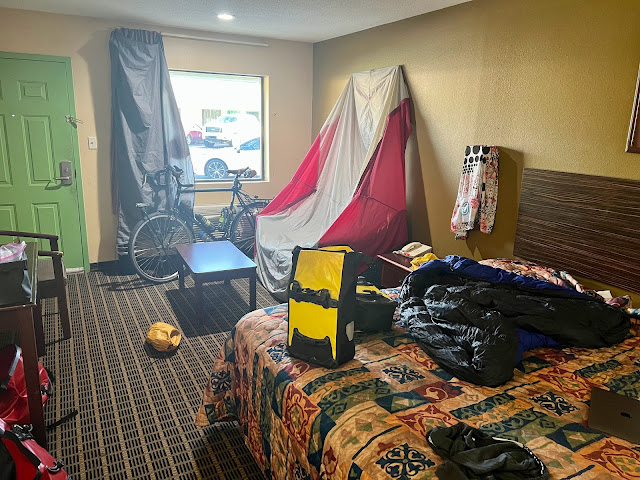
I entered Franklinton and rode into the center of town past the courthouse. I took a right onto State Highway 10 and got a room at the Liberty Inn. It was only $60 a night, but reeked of cigarette smoke. I spread out all of my wet gear to dry. I then showered, shaved, and charged my devices. I cycled over to Don Juan Mexican restaurant where I sat out on the porch. I ordered two margaritas, sea food burritos, and a few Modelos to enjoy while I edited this report.
April 14, 2022
Perkinston, MS to Franklinton, LA - 80 Miles
Start 9:02 AM Finish 3:22 PM
Ride Time 7:19
Ascent 2640 Feet
Descent 2582 Feet
Tour Total 135 Miles
Details at: https://ridewithgps.com/trips/87130324
Perkinston, MS to Franklinton, LA - 80 Miles
Start 9:02 AM Finish 3:22 PM
Ride Time 7:19
Ascent 2640 Feet
Descent 2582 Feet
Tour Total 135 Miles
Details at: https://ridewithgps.com/trips/87130324
The last place that I had stayed on part one of the Southern Tier tour was on Dauphin Island in Alabama. This made last night my first and only night in Mississippi. It was a rough night and I didn’t sleep very well. The storm rolled in around 11 PM as I was trying to upload images to yesterday’s report. It got windy and rain drops began spraying the picnic table where I was working. I quickly protected my things and retired to my tent. I had forgotten to zip up the tent after I had set it up, and a toad had wandered inside. When first erecting my tent, I wasn’t sure whether to set up the fly. It was warm and humid. I figured that if the storm was bad, the rain would blow in from the side. So I was cautious and installed the fly, which was a good decision. The rat-tat-tat sound of the rain hitting the tin roof above me made a nice sound. Then it became barrage of hard pelts. And then the thunder claps began. There were immense flashes of lightning followed by roaring booms of thunder. My main concern was a tornado. I was exposed on three sides with a large overhang structure above me. The slamming thunder startled me, and I could feel the ground vibrating beneath me. If things got bad, my plan was to go inside the building alongside the laundry machines and bathrooms.
The thunder eventually subsided but it kept raining. Somehow I eventually fell asleep. I wasn’t comfortable on the cement slab. My air mattress lost pressure as well as my pillow. I got cold in the middle of the night and pulled out my sleeping bag to use as a blanket. I was enveloped within my silk sleeping bag liner and was too tired to unzip the sleeping bag. At about 5 AM I finally opened the zipper. I had all sorts of weird dreams which is how I knew that I slept. This morning it was a slow pack-up. I heard a bob white chiming it’s call while rolling up my wet tent. Water had collected on my panniers. I had somehow forgotten to pack my cycling shorts and they had been blown halfway across the porch. It was 60° and I felt chilly. In addition to my cycling jersey and shorts, I put on my leg warmers and Legnano Pirelli cycling sweater. I washed my face with warm water and filled my water bottle before I headed out. There had been an outlet under the canopy and all of my devices were fully charged.
There were pools of water in the grass, and the stream that ran alongside the RV park was overflowing with brown muddy water. I took a left and continued onto Ten Mile Road. I then took a left on Perkinston Silver Run Road. It was gray and humid, and I had made the right clothing choice. I didn’t need the socks but my core and legs needed to stay warm. The road surface was wet. I had a four inch shoulder and rode to the left of the white line. There was very little motor traffic.
There were large cleared areas alongside the road. I noticed logging trucks and put the two together. By 9 AM the clouds were begining to slowly dissipate. Occasionally a Sunbeam would reach the ground. I cycled by the water tower and ostensibly the highest point in Stone County. Afterwards I enjoyed a nice downhill. I came to an intersection and took a left onto McNeil-McHenry Road. I noticed numerous signs saying ‘No dumping by order of the sheriff’. I saw the usual roadside soda cans and fast food trash, but not much else.
In Silver Run I took a right onto Silver Run Road and crossed into Pearl River County. At 9:15 AM it was still gray and cloudy. I passed an armadillo roadkill on the shoulder. At the intersection of Charles Toney Road I stopped to flip my paper map panels. I passed a large cactus bush in someone’s front yard, just as a dog ran out onto the road. I was caught off guard, but he didn’t give me much of a chase. I passed a series of signs saying that ‘Jesus is coming again’. A little dog chased me out onto the road and gave me a good run. I was a little concerned because I was wearing sandals.
I passed a large cow pasture to my left as the sun, once again, tried to pierce the gray clouds. There was blue sky to the west. I crossed over interstate 59 and took a right onto State Highway 53 into Poplarville. There was considerably more traffic and I had about 14 inches to the right of the white line.
I try to support local businesses and stopped at the delightful ‘Snowflake Donut and Taco’, where I ordered a sausage egg burrito and a spicy boudin, along with a bottle of Community Coffee mocha white chocolate iced latte and a minute maid orange juice. It was a solid choice all the way around. After breakfast I used the restroom and removed my leg warmers and sweater. I applied sunscreen before leaving. There were no longer any clouds in the sky. I rode into the center of town and took a left on North Street at the Pearl River County Courthouse.
Back out in the country I had another dog chase, although not serious. It took me forever to get the spray out of my handlebar bag. I took a sharp right on White Sand Road. After a few miles I came to an intersection and took a left on Homer Ladner Road. The sun was out and I was enjoying the shade from roadside trees. After a short while, I came to another intersection and took a right onto Holden Road. I noticed a turtle crossing the road ahead. An oncoming motorist was approaching, so I stopped to block the turtle and then scooted it over into the grass. I haven’t helped a turtle cross the road since my Trans Am tour in 2018.
I came to a T and took a right. I then took an immediate left on Archie Wheat Road. It was a narrow, rural, and bumpy road. I came to another T and took a right onto Old Camp Road, which was wider with center markings. There continued to be very little motor traffic, and the sky was now blue. The air had heated up considerably. It was pleasant riding on the mellow grades through the trees. I came to another T and took a left onto State Route 43.
My students would be taking a field trip later this afternoon in New York and I checked to see the temperature there. I was surprised to find that it was 80°F in New York. Here in southern Mississippi it was only 76° F. I saw another flag that was half stars and bars. The other half was red, white, and blue stripes which resembled a Russian flag.
In the town of Crossroads I took a right onto State Highway 26. The rumble strips once again stretched across half of the shoulder. The space beyond that was four inches of debris with a drop down into the ditch. So I rode to the left of the white line. My blogs should be required reading for all municipal DOT personnel as well as their contractors.
I passed a dead raccoon in the middle of the road and then came to the bridge that crossed the Pearl River into Louisiana. The welcome sign had blown over from last night’s storm, and I had to prop it up for the official documentation photo. I was now in the tour’s fifth state. I found myself in Washington Parish on Louisiana State Highway 10, headed towards Bogalusa.
In Bogalusa I rode through the sprawl and then took a left on Shenandoah Street. I passed the impressive Bogalusa High School Lumberjacks Stadium. Behind that sat the enormous International Paper Mill. Bogalusa got it start in 1906 on Bogue Lusa Creek with a campsite for the Great Southern Lumber Company, which became the world’s largest sawmill.
I missed a turn in Bogalusa and had to double back to the route. I stopped at Texaco for a fountain Coke on ice along with salted cashews. The cashier asked where I was going. When I replied Texas she and her partner both sneered ‘Ewh’! I continued through town took a right on W. 10th St. I was following State Highway 60 W.
I came to a T and took a right on State Highway 16 into Franklinton at the live crawfish stand In the town of Plainview I took a right onto State Highway 1072. I passed two dead possums in the middle of the road. On my way into Franklinton I passed a small airfield. I came to a T at the crawfish stand and then took a right onto State Highway 16 towards Franklinton.
I entered Franklinton and rode into the center of town past the courthouse. I took a right onto State Highway 10 and got a room at the Liberty Inn. It was only $60 a night, but reeked of cigarette smoke. I spread out all of my wet gear to dry. I then showered, shaved, and charged my devices. I cycled over to Don Juan Mexican restaurant where I sat out on the porch. I ordered two margaritas, sea food burritos, and a few Modelos to enjoy while I edited this report.
 |
| Evening visitor |


Comments
Post a Comment