Southern Tier Part 2 - Day #7 Kountze, TX to Cagle Recreation Area, TX
Southern Tier Part 2 - Day #7
April 19, 2022
Kountze, TX to Cagle Recreation Area, TX - 91 Miles
April 19, 2022
Kountze, TX to Cagle Recreation Area, TX - 91 Miles
Start 7:23 AM Finish 3:49 PM
Ride Time 8:26
Ascent 1595 Feet
Descent 1504 Feet
Tour Total 600 Miles
Details at: https://ridewithgps.com/trips/87599846
Ride Time 8:26
Ascent 1595 Feet
Descent 1504 Feet
Tour Total 600 Miles
Details at: https://ridewithgps.com/trips/87599846
I slept great last night in room 108 at the Super Eight Hotel in Kountze. I’d been told by the woman at the front desk that all the good food options were in Lumberton. The only restaurants in Kountze were Dairy Queen and Sonic Burger. So I picked up some canned margaritas, beer, and snacks from the Chevron. I enjoyed a warm bath along with a few cans of strawberry margarita and spicy nuts. Afterwards I had few Sierra Nevada‘s with corn chips. Not a very healthy dinner. I got up at 7 AM and noticed on my Windy app that the wind was out of the east today. I packed up quickly and hit the road. Other guests were enjoying breakfast in the lobby. They greeted me and wished me a safe ride.
I was wearing my leg-warmers and sweater in addition to the usual. The air was chilly and I thought about adding more layers. I rode back into town and took a right on West Deer Street that then put me onto Highway 1293. The highway had two lanes of traffic and a nice shoulder, with rumble strips taking up half of it. I could either ride 24 inches between the rumble strips and the cut-off, or ride to the left of the white line. I passed Kountze high school, which was on spring break.
The twenty, then eighteen, then fourteen inch wide space wasn’t enough to ride in, so I cut over to the left the white line. The rumble strips were deep and freshly cut. They shook me and my bike like electric jolts whenever I crossed them. Prior to today I hadn’t been able to see details on my map app. I realized this morning that the data settings were turned off. It was nice to have details again.
I was seeing some large ranch gates which perhaps rivaled some of the more impressive arches I’ve seen up north in Montana. This being Texas I expect and anticipate to see far grander before I leave the state. I was passed by empty lumber trucks going west and full lumber trucks flying down the road in the oncoming lane. I wondered if this was the dangerous section. Whenever a truck passed in my lane, I rode in the narrow gauntlet between the rumble strip and the cut-off.
After eight miles I entered Honey Island, no population listed. I stopped at the General Store where I ordered an egg sandwich with bacon and cheese along with a can of Loca Moca Java Monster. The cook didn’t skimp on the bacon. A round guy with short cropped gray hair and a handgun holstered to his large ass walked in and jokingly wanted to know why the pretty girl wasn’t working today. That wouldn’t fly in my orbit. As I was leaving he was asking the server if she had a boyfriend.
After breakfast I was back on the highway with light seventy mile an hour speed limit traffic. The wind forecast was still looking good. There were railroad tracks 300 yards to my right. The road was perfectly straight and level, and there was thick young forest to both sides. The sun started to brighten, and I noticed my shadow. The sky was still hazy. Logging trucks were coming from the west and the rumble strips continued to steal the prime shoulder area.
The highway elbowed to the south and I could feel the strong crosswind from the east. Fortunately I would generally be going west the entire day. I came to a T and took a right on Highway 787 headed west. I was in the municipality of Thicket, no population listed and no services. Highway 787 was perfectly straight with zero grade and trees to both sides of the road. Motor traffic was light. Logging trucks continued from the west and there were no more rumble strips on the shoulder, which was a blessing.
I encountered the ACA self-supported Southern Tier group. There were eleven of them, and they were headed to Silsbee tonight. After meeting the leader, I noticed the second third and fourth riders in a group out on the highway. I then passed the fifth rider. I passed the turn off for Highway 2798 towards Votaw and continued west towards Rye. A collie chased me out onto the road, and then just stood there.
ACA cyclists six, seven, eight, and nine passed me. I passed an F Biden flag and a Turd 24 flag. I was in solid Turd country. How do I explain to the average American how slimy and dishonest a New York City landlord / New York City real estate developer is. They are the most unethical people on earth. I find it unfathomable how anyone could follow that snake oil salesman's rot and filth. I guess it comes back to tribalism.
I crossed the Liberty County line. Rumble strips returned to the shoulder and the space to the right was unrideable. I was forced to ride to the left of the white line, which was harrowing when trucks passed. I came to the junction of Highway 146 in the hamlet of Rye. I saw ACA cyclist number ten in front of the Donut Express. A few more miles down the road I finally passed ACA cyclist eleven in blue. In Romayor I stopped at the Valero and got myself a red Gatorade. I removed my leg warmers and sweater, applied sunscreen, and put on my arm protectors. There were signs warning of roadwork ahead. The highway had turned south and the crosswind was intense. One lane of a bridge was closed and I had to wait at an automatic traffic signal. I came to a segment of grooved asphalt that was horrible to ride on. The white line hadn’t been grooved and I had four inches of smooth surface to either side. There was a gnarly cut-off into gravel on my right and grooved asphalt to the left with high-speed truck traffic. I bet this was the stretch where the cyclist was killed. I noticed a few large trees with Spanish Moss hanging from the branches.
In Dolen I took a right on Highway 223 and got off the highway from hell. Highway 223 was nice and smooth. Instead of rumble strips it had bumps added on top of the white line. I crossed the San Jacinto County line and there was a tractor pulling fourteen large rounds of hay. One of them had a large gash and was leaking. I was headed northwest and had an amazing tailwind. I felt like I was effortlessly gliding through the landscape. I came to a short 6% grade climb, which was the steepest thing I’d climbed since I’d crossed the Mississippi. It was 69°, sunny, and perfect cycling weather. The road was curvy with small ups and downs. I crossed over Coley Creek and rode into Shepherd, population 2,319. I crossed under US Highway 59.
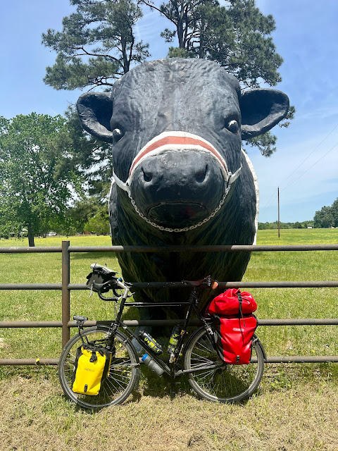
I came to a T and took a left on Highway 150, which had been recently been re-paved. The white line hadn’t yet been painted. I stopped at A+ donuts and got my sugar fix. On my way out of town I stopped to read a historical plaque. This area got it start in lumber and railroads. I crossed Big Creek and passed a nice little picnic area. I then entered Cold Springs, population 853. There were insurance dealers, gas stations, barbershops, and restaurants that smelled good. Lucky Star cleaners was giving away free Bibles. The town seemed active. A large flag was billowing and I could see that the wind was out of the north east. I had a strong cross wind cycling out of town, and then the highway bent to the northwest and I had the breeze at my back. I crossed the San Jacinto River. I rode past the Westmont Ranch and took a picture of the giant cement cow out front. It was small compared to Sweet Sue in Old Salem North Dakota. I passed a day cyclist going in the other direction. He shouted “Good job!” and I asked “How far are you going?” and he replied, “I’m just going home.” I entered Evergreen, no population listed. It was essentially the intersection with Highway 945. I then entered the town of Punkin, no population listed. The Punkin general store was closed as was gun store.
I crossed over Winters Bayou. There was a passing lane going west for many miles so I had a nice buffer between myself and westbound traffic. I crossed into Walker County and lost the passing line and the rumble strips. It was a beautiful area with forest to the left of the highway and cattle pastures to the right. All of the calves gave me a funny look, as if they’d never seen a cyclist before. The road became curvy and had rolls. An oncoming motorist in an SUV the size of a bus blasted his horn as he passed me. I don’t know what his point was. Anybody who’s driving something that large is obviously overcompensating for a shortcoming somewhere else, Uhem. Next a white oncoming pick-up truck was passing a motorcycle who rode in the middle of the lane. The pick-up crossed the double yellow and came to within feet of me. Motorists.
I entered the town of New Waverly, population 1032. I went to Willie’s BBQ & Burger for a BBQ sandwich and a Coke. Here I began editing this report. Afterwards I stopped at Slott’s Supermarket for a six pack of Dos Equis, a bag of Fritos, and a bag of ice. I rode through to the other end of town and crossed underneath Interstate 45. I continued west on Highway 1375 towards the Sam Houston National Forest. I had tried to call ahead to get a reservation for the campground at Cagle Recreation Area, but all I got was a recording. It was confusing and my plan was to camp there regardless. I entered the park and found the campground, which was open. It was $30 to camp and I didn’t have exact change, so I left $20 in the envelope. I chose site number nine and sat at the picnic table drinking Dos Equis and eating Fritos while finishing this report.


Comments
Post a Comment