Southern Tier Part 2 - Day #6 DeRidder, LA to Kountze, TX
Southern Tier Part 2 - Day #6
April 18, 2022
DeRidder, LA to Kountze, TX - 85 Miles
Start 7:46 AM Finish 3:03 PM
Ride Time 7:16
Ascent 1235 Feet
Descent 1356 Feet
Tour Total 510 Miles
Details at: https://ridewithgps.com/trips/87513135
April 18, 2022
DeRidder, LA to Kountze, TX - 85 Miles
Start 7:46 AM Finish 3:03 PM
Ride Time 7:16
Ascent 1235 Feet
Descent 1356 Feet
Tour Total 510 Miles
Details at: https://ridewithgps.com/trips/87513135
I slept fairly well at Amanda and Jen‘s house in DeRidder. Last night I had been all revved up from my century and had a hard time falling asleep. I could hear Jen snoring in the next room. She got up early this morning and I could hear the television and the dogs whining. The sun was starting to shine in through my window so I got up. I slowly packed and signed the guestbook. My devices were fully charged. Amanda pulled into the driveway just as I was about to leave. She had worked a 24 hour EMT shift. I was so glad that I got to meet her. I took a photo of my hosts as well as a we-fie. Amanda’s birthday is the day after mine and I’ll never forget her Wi-Fi password.
It never did rain last night, although I saw that there were was a path of tornadoes across Mississippi. The storm passed north of DeRidder. This morning It was 58°F and chilly. In addition to my cycling shorts and short sleeve jersey I was wearing leg-warmers and my sweater. Amanda told me to call her if I had any difficulties. In addition, I had reached out to Warmshowers host Kristi in Buna, Texas. I would be able to stay with her if I had a breakdowns or any difficulties. On my way out of town I stopped at Sunshine Groceries for a Starbucks Frappuccino and a bear claw.
US Highway 190 was two lanes of motor traffic and had wide shoulders. I noticed logging trucks on the highway. I passed grass fields and the headquarters of the Packaging Corporation of America. I noticed a long running wall and entrance to what looked like a planned gated community. Only nothing had been built. A few miles back I had seen another large excavation across the highway. There was definitely development activity here. I noticed large houses with handsome land parcels. I saw an estate entrance with perfectly spaced trees lining the drive that jutted way from the highway. It seemed to stretch forever and I was unable to see any stuctures. A black wooden fence ran alongside the highway for miles. I passed the Beauregard Civic Center and Covered Arena. It included animal stalls for county fair-type exhibitions and rodeos. There were athletic fields adjacent to arena. This area felt like the most affluent community I’ve ridden through in Louisiana.
I plugged in the Duane Train started cruising down the highway. I was all the way to the right and riding along the grass and separated from motor traffic by ten feet of expansive shoulder. The motor traffic was light to medium and there was tree bark debris in the shoulder. The wind was blowing strong from the north. A roadside flag was billowing. The breeze was coming across my right shoulder I could see on my map that there was an upcoming turn, and that I would get a tailwind.
What I love most about bike tours is practicing mindfulness. While I'm out here, I’m acutely focused on what I’m doing at every moment, and there’s just not enough time or energy to read the news or let my mind wander.
The roadkill frogs have been the largest I’ve ever seen in my life. I feel gross about photographing one but I should for the record. I came to a Y with Highway 111 and continued south on US 190. The wide shoulder continued and there was medium motor traffic I was headed south with the wind at my back. It was six miles to Maryville.
A wide load, a fifteen to twenty foot wide house, was being hauled down the highway. I felt secure with my wide shoulder and he used the oncoming lane to pass me I noticed the ‘Welcome to Maryville’ sign. This would be my last town in Louisiana. Maryville has a population of 1,122, and this area is known as TexLa. The center of Maryville was about a half mile off route and I stayed on 190 which wrapped around the outside of town. The highway took a bend to the west and the wind was now blowing at my right hip which I believed would work in my favor. Traffic was still medium and the shoulder continued to be wide. There were forests to either side of the road.
I crossed the Sabine River and entered the state of Texas, the Lone Star state. The old-school border crossing was way nicer than the new sign. I’d be in Texas for the next fourteen days and for the entirety of this part of the tour. In fact I wouldn’t even finish crossing the state tis time around, although I’d hopefully get close. I crossed over Quick Sand Creek. The inspection station was closed.
I want to begin my Texas crossing by calling out Texas Governor Greg Abbott and Texas Senator Ted Cruz who are both jackass grandstanders who care more about personal headlines and soundbites than caring for the average Texans whom they’re supposed to serve. What a bunch of buffoons! Go Beto.
I crossed Caney Creek and entered the small town of Bon Wier, no population listed. The gas station was shuttered, the café was closed, there were a few houses, and the post office and Citgo were open. I didn’t stop. I stopped and read a historical marker west of Bon Wier, and then took a left on Highway 363 towards Kirbyville. Highway 363 seemed to have less traffic. There were raised bumps under the white line and the shoulder width was inconsistent with encroaching grass, so I rode to the left of the white bumpy line. I passed through Famil. It wasn’t even on my map.
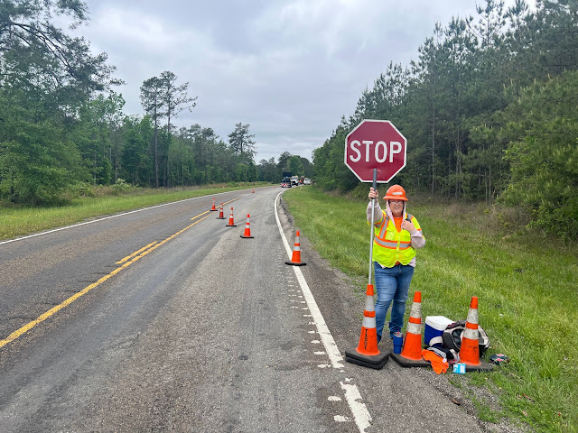
I crossed Davis Creek. The oncoming traffic was medium, but in my direction it was light. I would ride in the shoulder whenever motor vehicles were behind me. A wind gust from an oncoming truck almost knocked me off the road. There was road construction and a sign read ‘Be prepared to stop’. The flag person told me that they were fixing a hole. Down the road a dog half-heartedly chased me and then gave up. I crossed over big Cow Creek. A motorist followed me for about a mile with their blinkers on. That always makes me nervous because I like to hold anybody up.
I passed a warning sign urging motorists to slow down to 60 miles an hour to round a curve. It was a two-lane road. What the hell was the speed limit? A fast aggressive dog started chasing from the other side of the road. He almost got hit by an oncoming car. I had my pepper spray ready, but he retreated. I crossed over Thickety Creek, and was then in Newton County. I rode through Bleakwood, which was essentially the intersection with Highway 87. There were no services. A train track ran to the left of the highway with tanker cars lined up on a spur. The motor traffic got heavier as I got closer to Kirbyville, and there was no shoulder. I crossed the Jasper County line.
I crossed the railroad tracks and entered Kirbyville population 2,142. I came to US Highway 96. I had Googled my restaurant options and took a right to go off-route and into the wind to MJ’s Java Cafe. Once again Google maps let me down. There was nothing but fenced-up aggressive dogs. Riding back down Highway 90 I noticed a banner stretched across Highway 90 that announced the magnolia festival beginning the third weekend in April. I passed a thrift store, an auto body shop, and the Auction Barn. I crossed over Trout Creek. Elijah’s Café was closed. The parking lots of O’Reilly auto parts and Dollar General were empty.
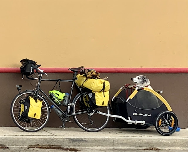
I spotted an east-bound touring cyclist towing a trailer bob, and crossed the highway to meet him. It was Sandy from Scotland, whom Amanda had told me about this morning. He would be staying with her and Jen tonight. He was traveling with bag pipes in his trailer. He gave me great advice on places to stay in Western Texas and had awesome stories. He would be continuing across the Southern Tier to St. Augustine, and then down along the coast to the Florida Keys before flying home from Miami. I crossed over Pine Oak Creek.
The second restaurant I had Googled was Las Palmas. It too was closed, so I rode to Jenny’s chicken where I ordered a shrimp po' boy, fried oysters, French fries, and a Pepsi. The sun was out when I left the restaurant, and I headed south on US 96 with the wind at my back. I passed a loaded male cyclist on a recumbent coming from the west.
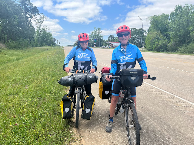
Unfortunately US Highway 96 remained four-lane divided. I noticed two eastbound cyclists and I crossed the highway to meet them. Marius and Honey, were from Holland, and had started their cross-country eastbound Southern Tier route in 2020. They had to end their tour because of Covid and were now taking care of unfinished business. They mention a stretch of bad road ahead. The Woman Tours girls had mentioned this yesterday, and it was advised to detour around the area. Apparently there was a gnarly narrow shoulder. The Dutch couple had stayed in the Super Eight hotel in Kountze where I was headed tonight. Marius said that it was super. I crossed Cypress Creek.
It was 78° when I rode into Buna, population 2,207. I was warm and pulled over to remove my sweater and leg-warmers. I applied sunscreen and put on my arm protectors. As I got close to Evadale I passed a dude out walking his dog in the middle of the shoulder. In Evadale, population 1,377, US Highway 96 turned a corner and headed west. I went up over a bridge and crossed the Neches River and into Harden County. I exited US 96 and rode into the town of Silsbee, population 6,527. I cycled into the center of town and then took a right on Highway 327 towards Kountze, which would be my destination for the day. A mile down the road I passed a flag that was half confederate and half Texan star. I crossed over Mill Creek, and then I crossed over Village Creek. I passed the Harding County Airport on the left. I had a nice wide shoulder and the traffic was medium to light.
The highway hooked north and I had a headwind on my approach into Kountze, population 2,198. I crossed over the Cypress Creek and entered the town. I got a room at the Super Eight hotel. In the lobby I met a gentleman who was waiting for two eastbound cyclist friends. The receptionist mentioned that many cyclists stayed here. I took a long bath and then set about editing this report.


Comments
Post a Comment