Southern Tier Part 2 - Day #3 Franklinton, LA to Jackson, LA
Southern Tier Part 2 - Day #3
April 15, 2022
Franklinton, LA to Jackson, LA - 91 Miles
Start 8:36 AM Finish 4:38 PM
Ride Time 8:01
Ascent 3414 Feet
Descent 3335 Feet
Tour Total 225 Miles
Details at: https://ridewithgps.com/trips/87229583
April 15, 2022
Franklinton, LA to Jackson, LA - 91 Miles
Start 8:36 AM Finish 4:38 PM
Ride Time 8:01
Ascent 3414 Feet
Descent 3335 Feet
Tour Total 225 Miles
Details at: https://ridewithgps.com/trips/87229583
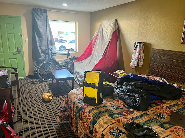
I slept incredibly well last night in room 121 at the Liberty Inn in Franklinton. Last evening after Don Juan’s, I returned to my room to catch up on some work from back home. The Wi-Fi was lightning fast and made me realize how slow my service was at home. Bill from Crazy Guy had correctly identified yesterday’s reptile sightings. In addition, I was juggling classes that I was teaching, and trying to find a pet sitter for this summer. I called Perry’s bike hostel to confirm my arrival and Perry encouraged me to take State Highway 10 the entire way. She promised a wide shoulder and road signs that urged motorists to yield to cyclists. She also mentioned that an eastbound had stayed with her last night, and that I we might cross paths. Long story short, I stuck to the route, and the east-bounder took the new route through New Orleans.
It was 67° F when I left the hotel and it was windy. I crossed my fingers that the wind would be at my back. I was wearing my cycling shorts and short sleeve jersey, and it felt cool. A few miles down the road I realized that I had left the sausage links in the refrigerator. I cycled back into town on State Highway 10. I crossed the Bogue Chitto River and stayed right at the split to remain on Highway 10. Most of the motor traffic remained on Highway 25 and it was much nicer on two lanes. In Richardson I continued west on State Highway 440. Highway 10 split southwest at this point. Aside from the Dollar General I saw little in the way of services. Highway 440 meandered through the trees with rolling ups and downs. They had painted a new white line about twelve inches to the right of the old white line which created an eight inch bike lane which I chose not to ride in.
I crossed the Tangipahoa Parish line. I passed Sunnyhill Grocery and Grub and decided to keep peddling. A group of large crows flew up out of the ditch as I approached. There must have been something yummy down in there. I realized that I had overshot a turn and decided to take a left on Joe Dyson Road. It was a loose gravel surface and would get me back to the route without having to backtrack. After about a mile I was back on route as well as smooth asphalt. I passed a small wooden sign with large black hand-painted lettering that read ‘HAPPY’. On the back of the sign facing the other direction was a smaller sign that also read happy. Right there on the road in front of the signs were two roadkill baby possums. I had mixed feelings.
The trees opened up to pastures of grass and yellow blooming flowers akin to canola. There were cattle in the fields. I saw a flag billowing and I realized that I was enjoying a tailwind. I crossed Highway 1061 at Bolivar, and didn’t see any services. I rode by Jewel M. Sumner high school and middle school which were both closed, ostensibly for Palm Friday. I noticed a timber operation across the highway. This area’s economy seems to rely on timber and cattle. I came to a T and took a right. Highway 440 had merged with Highway 1054. There were rumble strips underneath the white line and the shoulder was too narrow and uneven to ride upon.
I came to an intersection and took a left. Highway 440 had merged with Highway 1057. This was the road that I had been on earlier when I missed the turn and kept on going. The route that I had taken had little to no traffic and beautiful scenery. There was now a lot of fast moving traffic as I rode into Tangipahoa, population 748. There was a narrow shoulder and I used all six inches of it. I crossed up over the railroad tracks and noticed a store to my store/gas station to my left. I didn’t see a business name, and account of it being Good Friday they weren’t serving breakfast. I ended up purchasing two crawfish boudins and two shrimp boudins along with a Starbucks Frappuccino and an Ever Fresh pure 100% orange juice. The boudins were different from the one I had the other day. They were more like sausage, and I was later told that this was the traditional kind. Three of them completely filled me, and I didn’t need the second crawfish. I pedaled back the intersection and continued down 440. At the Chevron station I took a left on State Highway 1050 heading north. It was still overcast and perfect cycling weather. I crossed over Interstate 55.
After a while I came to a T and took a left on Highway 38. There was considerable motor traffic, rumble strips under the white line, and not much of a shoulder. The state of Louisiana is in the form of an L. The top part is skinny east to west, and the bottom part is wide. I was crossing the lower part, and it would take me several days to cross it. The majority of motorists here are courteous. They slow down and wait behind me, and then cautiously pass. I crossed into Saint Helena Parish. Louisiana is the only state in the union that divided its geopolitical territory into parishes instead of counties. I rode by Bebos fuel stop and casino.
The match-line was at Newman Road and I stopped to refold my map panels. While stopped I could feel the wind at my back. I was lucky to be heading west today. I was climbing a hill and was and was honked by an oncoming motorist who was being a jerk. I passed a Dollar General the intersection of Highway 441. There was a Help Wanted banner out front. I crossed the Tickfaw River and noticed on the maps that the Mississippi state line was just to the north.An oncoming motorist gave me a friendly tap tap. I passed the Hatfield Country Store in Easleyville at the intersection of Highway 568. Two miles down the road I passed a dead pig in the ditch. I was listening to Duane Train mix from WFMU and wish that my iPad nano had better volume.
I realized that I had missed a turn and had stayed on Highway 38 almost to Highway 10. I could have just proceeded on Highway 10 as per Perry’s suggestion, but I could hear the murmur of motor traffic. So I decided to hoof it 2.2 miles back to Chipola. After reconnecting with the route I located the sneaky westbound State Route 432. There was little motor traffic and at 1pm I began to feel raindrops. I crossed the muddy Amite River and entered East Feliciana Parish. After several miles of riding through the drizzle I came to a T and took a left on Highway 67 towards Woodland. There was considerably more more motor traffic but it had a nice wide shoulder. I passed a blue water tower as I arrived in Woodland. The rain got heavy and there were even claps of thunder. I missed the turn to Kent Road but figured it after less than a mile. When it rains my phone is unable to read my fingers. I can’t open my digital maps or make notes. I came to a T and took a left on Highway 422. I could still hear thunder in the distance but it had stopped raining.
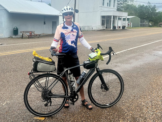
I noticed a white water tower in Norwood, and I stopped at the Texaco station Jets Food Mart for a Coke with ice and two small bags of Planters honey roasted cashews. As I was pulling out, I noticed a cyclist at the turn off. He was wearing an ACA Trans Am jersey and introduced himself as Jerry. He was doing the Southern Tier eastbound and his wife was providing SAG with a camper. They were mostly staying in RV Parks. He mentioned that he hadn’t been bothered by any dogs today. He wasn’t carrying pepper spray, and noted that I was traveling heavy.
Down the road I missed the turn off but only by about a hundred feet. Old Norwood Wilson Road was a delightful small country lane with no motor traffic. I passed through Wilson, population 595, and took a left on State Highway 68. I passed wide-open pastures with horses. I noticed a plethora of American flags and a radio mask with a confederate flag, a POW MIA flag, and a Don’t Tread On Me flag. The motorists here remind me of the drivers in Kentucky. They’ll patiently follow behind me for miles. Even when I’m only pedaling eight miles an hour, they won’t pass me. I have to occasionally pull over to let them pass. Just before 4 PM I rejoined Highway 10. I took a right towards Jackson to get some provisions before heading to Perry’s.
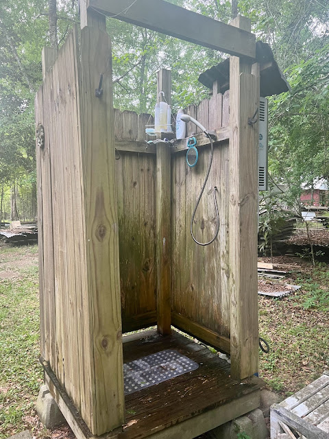
I stopped at the Star Supermarket for a six pack of Dos Equis, a box of macaroni and cheese, a few sausage links, and a small block of cheese. I doubled back to Highway 68 and continued to Perry’s. I was riding by the Dixon Correctional Institute and there were signs warning not to pick up hitchhikers. In front of the entrance to Dixon correctional institute were signs advertising that they’re hiring. I came to a section where only one lane was open. I was supposed to wait for a stoplight, but I kept going and rode in the closed lane. I found Perry’s bike hostel. There was a bike hanging from a tree out on the highway. I met Perry and her husband Lep. We traded stories and Perry showed be her Frankenstein touring bike complete with a Rohloff hub. I set up my tent outside under a rooftop and enjoyed a wonderful outdoor warm shower. Perry cooked us rice with a great bean sauce along with a salad. They told me that pigs ran wild in the woods here, and that they liked to hunt them at night. As I was editing this report I heard a shot in the distance. I’ll get the full story at breakfast tomorrow.


Comments
Post a Comment