Southern Tier Part 2 - Day #4 Jackson, LA to Bunkie, LA
Southern Tier Part 2 - Day #4
April 16, 2022
Jackson, LA - Bunkie, LA - 94 miles
Start 7:58 AM Finish 8:05 PM
Ride Time 7:04
Ascent 1030 Feet
Descent 1096 Feet
Tour Total 318 Miles
Details at: https://ridewithgps.com/trips/87356733
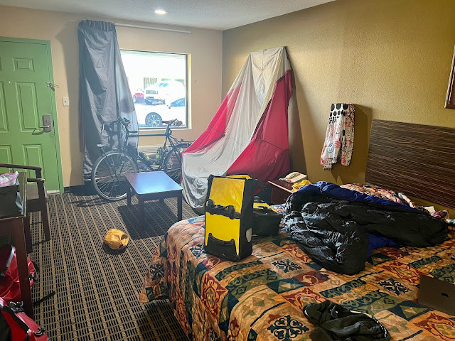
Last night after dinner I enjoyed ice cold bottles of Dos Equis lager while I edited yesterday‘s report. I slept well outside on the protected wooden platform at Perry’s bike hostel. There was a nearby pump / compressor that hummed all night long. I could also hear the traffic from nearby highway 68. This morning I woke up with the light. My towel and cycling clothes had been hanging on a line, and were wet from the humidity.
I enjoyed a morning coffee with Perry and Lep. The shot I had heard last night had apparently hit Pig Lib. They had nicknames for all of the wild pigs. After being hit, Pig Lib had scampered off by the time Lep had gone to retrieve it. Ostensibly the coyotes would get the spoils. Apparently pigs don’t bleed when they're shot. Their thick blubber seals the puncture. Perry told me that if I had any breakdowns or trouble to call her while I was still in her bubble. I was told that west of the Mississippi the topography would be flat. The land on the east side was formed by glaciers which accounted for the diverse flora and fauna. I rolled out onto highway 68 and a mile down the road realized that I had forgotten to start the ride on my Wahoo, so my stats would be short.
It was 72° F and overcast. Rain was predicted for later this afternoon. There was little motor traffic headed south on Highway 68. I would be re-joining the route just before I crossed the Mississippi. I passed a road kill snake in the shoulder. This morning I realized that I was hitting my stride. My body was adjusting to being out here, and it was invigorating.
I didn’t bring chamois butter this tour because I’ve seldom used it the last few times out. It would have come in handy this morning, so maybe I’ll pack a small tube next time. There was no shoulder on 68. I came to the intersection of Highway 964. A sign read ‘Road Closed Local Traffic Only’. I didn’t have a choice and proceeded though the barricades. The cows in the adjoining fields were skittish. I came to a second barricade that was ostensibly blocking a lane deteriorating from erosion. It didn’t affect me and I continued ahead. I came to a T and proceeded on four lane divided Highway 61, which was busy with motor traffic. Fortunately there was a wide shoulder.
They were doing roadwork and the left lane was closed. All of the fast moving traffic was funneled into the right lane right next to me. The shoulder was littered with debris. I came to the intersection of Highway 10 that headed west to the Audubon bridge to New Roads, and I took a left. Highway 10 was two lane traffic with wide clean shoulders. I was on the General Robert H Barrow US Marine Corps Memorial approach. Perry had promised that it would be a nice bridge crossing. I passed a road kill possum. I noticed two east-bound cyclists in the distance and crossed the highway to meet them. Medary was from Vancouver and Caroline was from Moscow, Idaho. They were riding the Southern Tier eastbound self-supported. They warned of wind and loose dogs, and had no idea where they were staying tonight. They were taking the new route down through Baton Rouge to New Orleans.
Next I met Nate and Gary, a father son duo riding from Austin, TX to Jacksonville, FL. Nate had a big slit in his rear tire and needed to get to a bike shop in Baton Rouge. I welcomed them to the east. The John James Audubon bridge was four lanes of motor traffic divided two and two. The wide shoulder was littered with debris. I swallowed a large bug as I approached the bridge.
Two other east-bound cyclists passed me on the bridge. Because of the jersey barriers and traffic, we could only wave to one another. I entered Pointe Coupee parish and was now west of the Mississippi. I rode down the west ramp of the bridge, the Jones J. Jan approach. The first thing that I noticed, was how flat it was west of the Mississippi. Perry was right.
Yesterday’s wind forecast showed the breeze coming out of the south west from the gulf, and getting stronger as the day progressed, which would affect me. I took a left on business 10 towards New Roads. I passed a lot of trailer homes coming into town. I noticed a unit with siding coming undone and the insulation exposed. The guy who lived there was out in front and we greeted one another.
I’d arrived at the end of map section 6 which I had started in DeFuniak Springs, FL last year. I stopped to flip my maps. I was now on the ACA Southern Tier map section 5, New Roads, LA to Navasota, TX. I called the fire house in Bunkie to see if I could spend the night there. I was now planning do another 90 mile day. Tomorrow had been planned as a century, which could now be adjusted. I ate the two pieces of toast that Perry had given me and I continued down the road.
On the other side of New Roads I found myself back on Highway 10, riding out through the sprawl passing lumberyards, grocery stores, taquerias, home furnishing stores, garden stores, tractor equipment, gas stations, and Pablo’s truck stop and casino. I passed the False River regional Airport. Train tracks were to the left of the highway and the Mississippi River was to my right.
I passed a big fluffy black and white freshly hit possum. Approaching Labarre I could see a football stadium in the distance to the right. There was a lot of traffic on Highway 10. I had a nice wide shoulder but the motor traffic was tiresome. I was still wearing my clear goggles. It was gray out and my sunglasses would’ve been too dark. I’ve been seeing fleur-de-lis everywhere in Louisiana. I’ve seen them painted, carved out of wood both large and small. People here are proud of their French heritage.
The next town was Morganza. Sweet Williams antique was boarded up and LeBlanc's Processing was closed today. There was an American flag out in front of the Red Apron. Highway 10 split off to the left and I continued on Highway 1. I was on the MRT, the Mississippi River Trail, which I haven’t ridden since 2020, in Minnesota and Wisconsin. Highway 1 was busy with motor traffic and had a wide shoulder. The railroad tracks were to my left and the river was just to my right. At one point I rode up atop the levee.
I came to a causeway with a mechanical system for raising and lowering the floodgates below. There was no shoulder or space to ride on the roadway. Despite the Do Not Enter signs I rode along the tracks for the floodgate machinery. I was separated from traffic by an arched cement barrier. I had to clear a car tire and a large piece of foam from the path. My paper map and Google indicated a restaurant in Old River Landing which would be open when I arrived. I was looking forward to a nice early lunch.
The route left Highway 1 for a scenic extra five mile detour, which I figured would be worth it to get away from the busy highway. I took a right on Highway 972 and continued to follow the MRT. There was absolutely no traffic on 972 as I rode past plowed fields heading back towards the river. At the river I took a left on Highway 419.
There was a large turtle in the middle of the road and I stopped to move him safely to the other side. The poor thing was scared and a flood of urine pooled in the road. The bugs were bad. Old River Landing, despite Google maps hours, was not open. There wasn’t a soul around. It was really buggy and I escaped as fast as I could. I was riding Highway 419 towards Batchelor.
I noticed a large bird tearing apart an armadillo in the middle of the road. He flew off before I could get a good photo. I stopped at the Exxon station in Batchelor. The Daiquiri Express was closed because of Easter tomorrow. I got myself an Oreo International Delight Iced Coffee made with real milk and cream. I put on my sunglasses before I left.
I crossed Highway 1 and continued on Highway 419 where I met cross-country cyclist Bob from Rochester, NY. He was riding the entire southern tier from San Diego to St Augustine and his wife was providing SAG support. He mentioned that there was a loose dog about 4 miles down the road that would probably chase me. He mentioned that he had been bitten by a dog in California.
I came to a T and took a right on Highway 417. I then stayed left at the Y to remain on 417. At noon the sun tried to break through the clouds. I was riding alongside the lovey Atchafalaya River that went through Simmesport. Friendly folks sitting out on their porch waved to me. All of the cemeteries here feature above the ground vaults.
As I approached Simmesport I could see the Simmesport bridge across the river in the distance. I rejoined Highway 1 to cross the river. It was the Atchafalaya National Heritage area and there was not much of a shoulder on this bridge. I noticed a sign, Welcome to Atchafalaya Cajun Crossroads. Both Robalais Seafood the Family Grill were closed. Simmesport had been my original destination for the day. It was 1 PM and I had only ridden 60 miles. There wasn't much happening. I took a right on Laurel Street and then a left on Main.
On my way out of town on old Highway 1, I ran into eastbound cyclists Peter from San Diego and Janet from South Dakota. They were both part of the ACA supported group. They told me that they would be taking the old route, and would be staying at Perry’s tomorrow. They were staying in Simmesport this evening. They mentioned that there was an ACA eastbound self-supported group following after them.
A levee was to my right and Highway 1 and a railroad track were to my left. A large black dog startled me out on the old highway, but he didn’t give me much of a chase. I noticed other members of the ACA supported group over on Highway 1 but the old highway was a much better ride, without any traffic. I got chased by a white dog but it wasn’t serious. He gave up pretty quickly. In Hamburg I took a left on Highway 114 towards Moreauville. I crossed over the railroad tracks and then over Highway 1. I then took a left on Highway 114.
I met solo self-supported eastbound cyclist Jolene from Oakland. She was riding with Tammy, who was part of the supported ACA group. Jolene was planning to go to an RV park tonight. They mentioned a church festival in Cottonport where I could get some home-cooked food. They were enjoying their tailwind but told me that I would get one later in the day. I rode into Moreauville, population 927. I was hungry and the Holy Cow, back up on Highway 1, sounded like a good option. They didn’t answer their phone, and I risked going a mile off route to see if they were open. Unfortunately they were closed. Damn! It looked like a great place. I backtracked to the Y Not Stop convenience store / Shell station and I got myself a Coke on ice, a Slim Jim, and a small bag of cashews. I sat at a table inside as I flipped my map panels and tried to reconfigure the next couple of days. I was getting ahead of my itinerary which might mean a night in Austin. I would need to cancel and re-book with Warm Showers hosts.
I rode out of town on Bayou Des Glaises Street a.k.a. Highway 114. I took a left on Highway 29 to Cottonport and found myself on the Louisiana Colonial Trail. The cornfields had all been planted and the stalks were ankle high. I entered Cottonwood, population 2006. Going through town I took a left at the T and was on a Scenic Louisiana Byway with a pleasant waterway to my right. I never found the church barbecue that the girls had mentioned.
Riding out of Cottonport at around 3:20 PM it began to sprinkle. I then got seriously showered on and then the rain stopped. I rode into Evergreen, population 310. The stretch to Bunkie had no shoulder with fast-moving traffic. I was hungry and stopped at both The Dugout and at Rockies. Everything was closed. I rode through the handsome downtown that had seen better days. Jimbo’s Crawfish and Daiquiri Barn was an option, but I continued to Zapote where I enjoyed a shrimp burrito, chips and salsa, two margaritas, and several Dos Equis, while I edited this report.
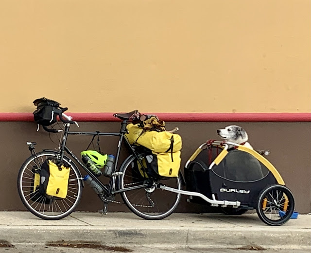
I headed over to the firehouse where I would be staying, and was told that two eastbound cyclists had gotten my spot. I would be staying at another fire house on the other side of the railroad tracks. I met east-bounders Gary and Amy from Ft. Collins, CO before I left. We traded stories and then I pedaled over to te other fire station. I scored, because I’d have a room to myself with a mattress. I showered, finished this report, and enjoyed a nice cold Modelo.
 |
| Perry and Lep enjoying their morning coffee |
 |
| Road Closed, but I proceeded anyway |
 |
| Self-supported eastbound cyclists Medary and Caroline |
 |
| Self-supported eastbound cyclists Gary and Nate |
 |
| Eastbound cyclist on the John James Audubon Bridge |
 |
| Eastbound cyclist on the John James Audubon Bridge |
 |
| John James Audubon Bridge across the Mississippi River |
 |
| Front yard plants and decorations |
 |
| Bayou country |
 |
| Crossing the causeway |
 |
| Rescued red-eared slider |
 |
| Bug infested Old River Landing |
 |
| Interrupting this bird's lunch |
 |
| East-bounder Bob from Rochester, NY |
 |
| Simmesport bridge |
 |
| East-bounders Peter and Janet |
 |
| Self-supported east-bounder Jolene |
 |
| East-bounder Tammy |

 |
| Self supported east-bounders Gary and Amy |
 |
| Map & Elevation Profile |

Comments
Post a Comment