Southern Tier Part 2 - Day #14 Seminole Canyon State Park, TX to Sanderson, TX
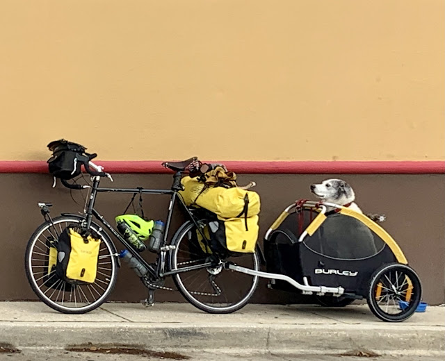
East-bound cyclist Jean aka JABIG
Southern Tier Part 2 - Day #14
April 26, 2022
Seminole Canyon State Park, TX to Sanderson, TX 81 Miles
Start 7:34 AM Finish 3:20 PM
Ride Time 7:46
Ascent 3,903 Feet
Descent 2,531 Feet
Tour Total Miles 1207
Details at: https://ridewithgps.com/trips/88285196
April 26, 2022
Seminole Canyon State Park, TX to Sanderson, TX 81 Miles
Start 7:34 AM Finish 3:20 PM
Ride Time 7:46
Ascent 3,903 Feet
Descent 2,531 Feet
Tour Total Miles 1207
Details at: https://ridewithgps.com/trips/88285196
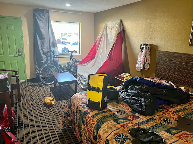
I slept well at Seminole Canyon State Park at primitive site #44. Last evening I sat at the picnic table and enjoyed a nice hot serving of Backpacker's Pantry Pad Thai, along with ice cold bottles of Fat Tire. I met some neighboring campers who were motoring from Minneapolis. They would be heading to Big Band which I regret that I wouldn’t be visiting. It rained throughout the night and my tent fly was soaked in the morning. Last night got cold and I enveloped myself in my silk liner and sleeping bag.
This morning was a slow pack up under a slight sprinkle. Everything was wet, which was good for the locals. I had to stow my drenched tent fly underneath the rack pack. It was overcast when I departed and the rain had subsided by the time I started. In addition to the usual I was wearing leg-warmers, socks, a sweater, and a rain jacket. Bunnies and road runners were bounding through the surrounding scrub. I saw a deer running across the road as I left. I took Highway 67 back to US Highway 90. I could hear the traffic from US Highway 90 all night long. The US Border Patrol was out on duty early, keeping our country safe from poor desperate people fleeing gang violence.
I crossed the Pecos River which had carved a beautiful canyon. I was only about a mile from the Rio Grande. Railroad tracks cozied up to the right side of the highway and there were twenty four freight cars parked on a spur. I was riding through a section where the Pearl River snaked to within a mile of the serpentine Rio Grande. This area is known as the Shumla Bend. All of the hills I was seeing to the south were in Mexico. At 8:30 AM it started to sprinkle.
There was a sign that cautioned crosswinds but things were pretty wind-wise. I had a slight tailwind. An Amtrak train passed going west. The drizzle lasted for about 30 minutes, during which time I couldn’t wear my goggles or rearview mirror. I spotted towers and buildings in the distance which I assumed to be Langtry. Three trucks with wide load escorts barreled down the highway with ginormous green tanks that were wider than the lane itself.
I crossed over Eagles Nest Creek, a beautiful smooth carved canyon, and I could see the Rio Grande to the left. I took a left on Highway Loop 25 to go through Langtry. The town greeted me with a confederate flag. Stefan had been right. Langtry was a shit hole. I passed the Judge Roy Bean Visitor Center, a historic museum, but didn’t stop. Langtry was located right alongside the smooth canyon walls of the Rio Grande.
The wagon Wheel Cafe Store out on US 90 was closed. It was my only possible food option for the day. Like an idiot I hadn’t packed any food for today, not that there were many choices back at the Quick Stop in Comstock. Dryden was 41 miles to the west and Sanderson was 60. It started to sprinkle again as I crossed over Osman Canyon.
There was nothing out here but scrub. US Highway 90 cut northwest after Landry and away from the Rio Grande. A semi truck was pulled over on the shoulder with the hood up. The driver was pouring what looked like cooling fluid into the chassis. I asked him if everything was OK and he replied that it was. I saw a motorist towing a trailer that contained a helicopter. I believe this was the second time I’d seen that on a bike tour.
I passed a Border Control pick-up truck with an empty horse trailer parked on the side of the road. This section could be described as rollers, gentle ups and downs with nothing too steep. I’ve had no phone service since Del Rio. I passed an eastbound cyclist who wasn’t carrying anything and had no interest in stopping. He waved and continued.
Today I was once again listening to WFMU’s $mall ¢hange who was totally kicking out the jams. I crossed over Antonio Creek. I came to the intersection of State Highway 1865. I crossed the Terrell County line which was a machine and time to flip my map panels. Dryden was 26 miles ahead and Sanderson was 46. I crossed Lozier Canyon. I passed a parked Border Control pick-up truck with an empty trailer and a large fuel container, ostensibly for ATV’s.
The land was flattening out but the elevation was rising. I saw a sign that read Dryden 10 miles and Sanderson 30 miles. It was 12:19 PM. I met east-bounder JaBig, aka Jean from Vancouver who was doing a perimeter ride around the United States. He was self-supported and staying in hotels. He had spent last night in Sanderson and was hoping to make it to Del Rio today. At 1PM he still had 96 miles to go. He said that the headwinds yesterday had been demoralizing. He assured me that I would have tailwinds to Marfa tomorrow. He was cold and regretted sending some of his stuff ahead. He mentioned that there were western cyclists ahead of me. Jean was a camel like me, and carrying just a sandwich. He could just get up and crank out the distance. He thought that I had a little bit of a tail wind today.
I saw a sign for the Dryden General Store one mile ahead, and I kept my fingers crossed. I was on the Far West Texas Nature Trail. I could see a town in the distance and the train track merged back alongside the road. I entered Dryden, no population listed. There were no services and Dryden had definitely seen better days. Sanderson was 20 miles ahead and Alpine was 104.
I was once again riding along side railroad tracks and I passed the Terrell County Airport. There was an oncoming Union Pacific freight train sitting idle on the spur and I got the engineer to blow the horn. My clear goggles pinch my temples so at 2:06 PM I swapped into my sunglasses. It continued to be overcast and I was still wearing my rain jacket and sweater.
I crossed over Sanderson Canyon and was ten miles from my destination. For the first time since Del Rio, I once again had spotty Internet service. It was 60°F and actually perfect cycling weather. Friday it was forecast to be 94°F. I had been steadily climbing all day and believe that I was now at the highest elevation yet on this tour.
At 2:30 PM I finally removed my rain jacket. I was ten miles from Sanderson. I got to the top of a climb and could see mountains ahead. I was now over 2600 feet. I crossed back over Sanderson Canyon as well as the railroad tracks which were now on my left hand side. I saw a plaque that I was on a Blue Star Memorial Highway.
Two miles out from town I began to see buildings ahead. And then I entered Sanderson, population 837. I had pictured myself diving into a cheeseburger with a pint of cold beer at 3:30PM. I had Googled restaurants and had came up short. There was nothing open today. I stopped at what I thought was a restaurant, but it was a limited grocery store. I bought a bottle of Coke and sat outside to upload yesterday’s report. I rode to the west end of town where I purchased a six pack Dos Equis, chips, Slim Jims, and two horrible hot dogs. It was my only option.
I cycled back to Canyons RV Park where I met Hannah who was supporting her partner Chuck cycle cross-country from San Diego, CA to St. Augustine, FL. They’re both cancer survivors and run an organization https://www.getupandlive.org which I urge my readers to support. I set up my tent on an astroturf area reserved for tents, and used large rocks to hold the tent in place. I edited this report at a cold windy picnic table. Chuck later brought me over a bowl of chili. He and Hannah were hosting two east-bound cyclists in their RV. I met east-bounder Macau from Los Angeles, who would be riding to Langry tomorrow. There was another couple in an RV who were taking turns riding 25 mile stretches. A freight train track cut right alongside the RV park.


Comments
Post a Comment