Southern Tier Part 2 - Day #13 Brackettville, TX to Seminole Canyon State Park, TX
Southern Tier Part 2 - Day #13
April 25, 2022
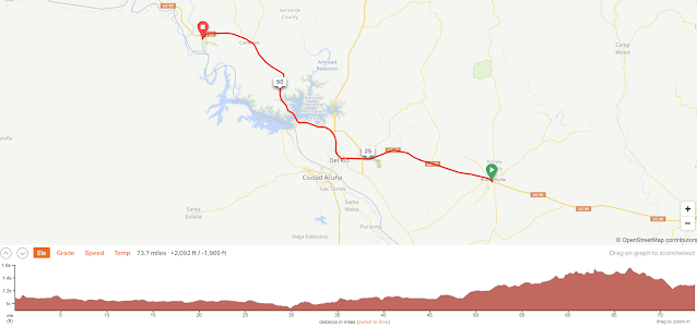
Brackettville, TX to Seminole Canyon State Park, TX 74 Miles
Start 7:14 AM Finish 5:41 PM
Ride Time 10:26
Ascent 2,092 Feet
Descent 1,909 Feet
Tour Total Miles 1126
Details at: https://ridewithgps.com/trips/88285194
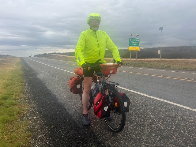
I slept well in room B6 in the Fort Clark Springs Motel. It never did rain last night and thunderstorms were now forecast for today. I was well-rested and prepared for whatever would come my way. The goal was Seminole Canyon State Park, which was after Comstock. That would make tomorrow’s haul to Sanderson only 80 miles. Tomorrow had originally been scheduled as a 121 mile day. A sign reminded me that I was still on the Texas Pecos Trail. I was wearing my freshly laundered short-sleeve jersey and bicycle shorts, and I was listening to WFMU’s $mall ¢hange. I took a left on US Highway 90. I was getting close to the Mexican border and was seeing border control signs and lots uniformed personnel. Border patrol motor vehicles and surveillance cameras were everywhere. I would not want to be a migrant out on foot here.
US 90 had two lanes of high-speed motor traffic. There was medium volume traffic and a wide shoulder with rumble strips taking up the left half. The right half was bumpy, which made dictation problematic. The wind was supposed to be out of the northeast today and I might luck out. The winds might work for the next couple of days, but it’s the final few days that I was worried about. A passing lane opened up and then ended, and the nice smooth shoulder returned. There were barbed wire fences on both sides of the road. Beyond the fences was scrub. It was overcast and a storm was on the horizon. I crossed Pinto Creek where I saw a few pools of standing water.
By 8 AM I had ridden ten miles, and I could feel the air temperature drop, which was probably related to the storm. I crossed Big Perdito Creek which was completely dry. I could see yellow flashing lights suspended over the highway in the distance. Then I crossed the Little Big Perdito Creek. I came to the intersection of State Highway 3008. There were State Troopers parked in opposite facing corners. Del Rio was 18 miles ahead and Sanderson was 138 miles. I would be in Sanderson tomorrow night.
The passing lane returned to my side of the highway, which meant a narrow chunky shoulder. So I rode to the left of the white line. There was now a railroad track running parallel in the highway on the left. My feet have been sore from riding in sandals, so I pulled over to put on some socks. I immediately felt a difference. I crossed over Sycamore Creek and entered Val Verde County. There were standing pools in the creek but it was mostly dry. The receptionist at the hotel yesterday had mentioned that this area needed rain.
There was a National Weather Service Advisory for a strong thunderstorm with 40 mile-an-hour wind and penny-sized hail. It sounded like I was going to get wet. A week from today I’d be on a plane heading back to New York. Last night I managed to take care of some of my work obligations. Up ahead to the left I could see the water tower and control tower for Laughlin Air Force Base. On my side of the road was a closed fireworks stand and a paintball outfit. A friendly collie galloped towards me. He stopped before he got to the road, and he was smiling. Then I rode into Del Rio, population 35,591 and created in 1868.
All of my weather apps indicated a severe thunderstorm warning and the sky ahead was dark. Comstock was 36 miles ahead. I was kind of hoping that the rain would just let loose in Del Rio, right when I was in front of a restaurant. I stopped at a Stripes Convenience Store and got a Starbucks Frappuccino, a Simply Orange 100% juice, and a Coffee Cakes cinnamon streusel.
As I was headed out of town I noticed that all of the motorists were pulled over to the side of the road to allow for a funeral procession in the oncoming lane. We all waited until sheriff passed in the rear. The sky ahead was black and I seemed to have shelter options along the route for the next few miles. The wind was in my favor and I wanted to take advantage of it. I really needed to make it to Seminole Canyon State Park today to guarantee that I would be in Marfa on Wednesday. Urged by eastbound fellows cyclists I texted Warm Showers host Manu and got an OK to stay with him.
I got onto US Highway US 90 West, which was actually heading north out of Del Rio. I had a strong headwind. I was headed northwest and the wind was from the northeast. Many of the billboards were in Spanish. I was just a few miles from the Mexican border. I passed a road sign that read Comstock 27 miles, Seminole Canyon Forest 37 miles, and Sanderson 115 miles. I noticed an RV park that was closed to the public and yet it was jam packed with RV’s and surrounded by security. I had a feeling that migrants were being housed here. It started drizzling, the wind was in my face, and I was getting cold. The worst of the storm seemed to be to the north. I would be riding through the Amistad National Recreation area, which was a reservoir that spanned the international border. Because of the rain and rain puddles, I was really appreciating my fenders. They were keeping my toes from becoming soaked.
I pulled over underneath a gas station canopy to put on my rain jacket. I later stopped at the Champion Inn for a breakfast egg and chorizo taco, and an orange juice. Back on the road it continued to drizzle, and I passed the Highway 349 spur that went down to the border and the Amistad dam. I could see the border crossing in the distance. I would be crossing over mile and a half section of water. I could see the train bridge up ahead, and then I began to notice the reservoir to my right. It was difficult to use my phone because of the rain. I rode by Box Canyon and then crossed over a creek where there had once been a train crossing. I could hear thunder to the north and saw a bolt of lightning. I came to the intersection of Highway 406 Spur and stayed west on US 90 towards Comstock. I passed a US border patrol stuck in a mud puddle. The drizzle finally stopped and I was able to put my sunglasses back on, and return my phone to the handlebars.
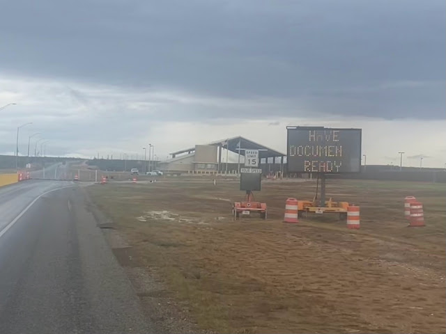
I met east-bounder Stefan from Stuttgart Germany. He had stayed in Langry last night, between Comstock and Sanderson. He said that was it was dirty and that he wouldn’t recommend it. He was headed to Del Rio today. His ACA paper maps had never arrived, and he was navigating with a Garmon. He asked where I had gotten my rearview mirror. There was a checkpoint up ahead and a sign that said ‘All vehicles must stop’. Two small deer charged across the road. I rode into the immigration inspection point and was ostensibly photographed. I asked the person on duty if I needed to show ID. He asked if I was an American citizen, and I answered yes. He then he that I was free to continue.
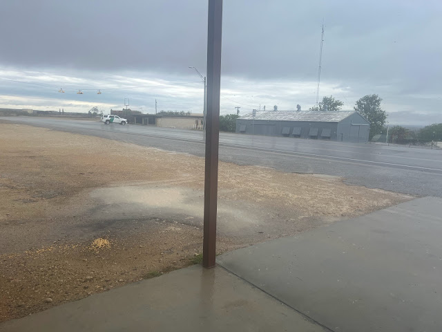
There was a state trooper sitting on the other side of the road as I rode into Comstock, no population listed. There were no services for the next 89 miles and the plan was to go 10 more miles to Seminole Canyon State Park. It was 1:14 PM and I had traveled 62 miles. The plan was to get something to eat and sit out some of the rain. I stopped at the Quick Stop and got myself a pepperoni pizza slice and a Coke. I went outside to a picnic table underneath a canopy, just as the sky opened up to an incredible downpour. I couldn’t believe my incredible timing. I sat there and did grading for my classes, and edited this report. A guy who worked there told me about how beautiful Big Bend was, and I was sad not to have enough time to visit. He recommended the J&P Bar & Grill down the street for lunch and said that it would get hilly after Seminole Canyon.
Once it cleared up I rode to J&P where I ordered a few Modelos, some chips and salsa, and a cheeseburger with fries. The proprietor had met Stefan earlier this morning. He said that the downpour had produced 1-3” of rain. I charged my phone and devices in the warm bar. It had gotten cold outside, and I put on my sweater and leg-warmers in addition to my shorts and the rain jacket. I returned to the Quick Stop for a six pack of Fat Tire and then headed towards the campground. A road sign read ‘Next services 88 miles’. There were dirt tracks to either side of the highway which were used by state highway patrol and US border patrol looking for illegal migrants. I saw numerous roadkill deer carcasses before I crossed Seminole Canyon.
I took a left on Highway 67 into Seminole Canyon State Park. I was following the original roadbed for the Southern Pacific Railroad built in 1882 and abandoned in 1892. The park office was closed and I proceeded to the primitive camp sites, and set up at site #44. The wind gave me a bit of a challenge with my tent, but I now had plenty of experience. I sat at the picnic table and finished editing this report.





Comments
Post a Comment