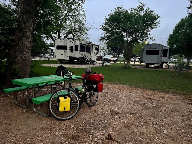
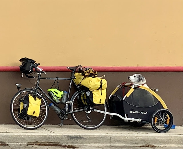
Southern Tier Part 2 - Day #9 La Grange, TX to Austin, TX
Southern Tier Part 2 - Day #9
April 21, 2022
La Grange, TX to Austin, TX - 82 Miles
Start 6:41 AM Finish 4:30 PM
Ride Time 9:28
Ascent 3,267 Feet
Descent 2,900 Feet
Tour Total 784 Miles
Details at: https://ridewithgps.com/trips/87797508
April 21, 2022
La Grange, TX to Austin, TX - 82 Miles
Start 6:41 AM Finish 4:30 PM
Ride Time 9:28
Ascent 3,267 Feet
Descent 2,900 Feet
Tour Total 784 Miles
Details at: https://ridewithgps.com/trips/87797508
I slept well at the Colorado RV park in La Grange. I slipped in after dark and was gone before sunrise. It was my first RV sneak-in for this tour. Last night it got hot in my tent and I slept on top of my Thermarest without my silk liner or sleeping bag. I got up in the middle of the night to open up the fly side panels and let some air in. There was condensation on the fly this morning. It was a quick pack up except that my toothpaste cap jumped out of my hand and it took a while to find it in the dark. Dogs began barking and the trash collection came through before I left. I pedaled back to US 77 and then took a left past Las Fuentes. I passed back over Highway 71 and stopped at a Texaco on the far edge of town. I got myself a Starbucks Frappuccino, a Tropicana 100% Orange Juice with pulp, and a pack of Hostess Donettes. As I was enjoying my breakfast out in front of the Texaco station, the Sacred Heart Catholic School Indian band pulled in. There was only one bathroom stall, and it was amusing to see the quiet gas station spring to life.
Back out on the road, I passed the Texas Czech Heritage and Cultural Center and then the Fayette County Fairgrounds. The wind was out of the south again today. For my first segment, I would be going north. The Texas flag was half fluttering in front of the Saint Marks Medical Center and I could see that the wind was coming from 150° south by southeast. I passed Highway 2145 and noticed a new condominium complex under construction. I passed the Texas Quilt Barn which wasn’t open. The hours were 10AM to 5PM, and it was 7:30 AM.
There were elevation profiles on the back of map section 4 and I knew that I’d be going through Texas Hill country. This morning I experienced the first real climb of this tour. I’m not concerned about climbing. The wind is what concerns me. I passed Beerz Burgerz, who advertised the best burgers in Fayette County. I checked my digital map and realized that I missed a turn. It was now misting.
I’ve been seeing tanks in the fields and today I saw an oil jack. I was on State Highway 153 headed west towards Winchester. The shoulder was narrow. I was riding through grassland pastures framed by trees. It seemed like prime grazing pasture and I didn’t see any fences. I rode past the Lazy Q Ranch which advertised training services.
I rode through Winchester, no population listed. There was little motor traffic on the road, which was winding with small ups and downs, and trees to both sides. It was overcast, as I crossed into Bastrop county. I came to a T. Highway 153 joined up with State Highway 2104 and I took a left preceding west towards Beuscher State Park. I was at the top of the ridge and had a nice downhill into the valley, where I sped 35 miles an hour. There was a fruit orchard down below. Traffic became heavier and I would ride in the shoulder whenever a motor vehicle would pass
I rode into Beuscher State Park and quickly realized that the route wanted me to take a road that was closed. They were actively working on the road using heavy machinery and I was able to slip through. The work area was heavily barricaded and I carried my bike across the barriers. It was a miracle that no one saw me or stopped me. After the work area I had the road to myself. I enjoyed the canopy of trees above me, some with Spanish Moss. It was gentle ups and downs and plenty of curves. I could have alternatively stayed on Highway 71/95. It would have been faster and more direct. But riding through the park was a treat.
It was beautiful riding through the park. There were twists and turns and the road was surrounded by small trees. Workers were wood chipping in one area. Afterwards I noticed that another area had been burned. I was humming along and all of a sudden a large brown dog lunged out of nowhere. Fortunately I was going fast. It caught me off guard. There were 11.5% grades and definitely the steepest hills so far on the tour. Fortunately the climbs were short. It was a good thing that I wasn’t towing Blanka this time. I finally came out through Bastrop State Park. The two parks were connected.
I left the park and found myself on busy four-lane Chestnut Street headed towards Bastrop, population 7218. The town had been established in 1832. I was on W. State Highway 21, and crossed the Chief Petty Officer Stephen “Matt” Mills bridge over the Colorado River. I took a right on the Old Austin Highway and then took a left on Hasler Boulevard and went by the H-E-B plus grocery store. A strong wind was blowing directly at me. I took a left on the State Highway 21 Frontage Road. I took a left on State Highway 304 going south which had a serious headwind. I stopped at a Texaco for a Coke, some cashews, and to flip my map panel. I then took a right on Shiloh Road headed west.
I went right on N. Gaines Rd. headed north. I was basically running parallel to busy highway 71 through small pastures scattered with trees and bushes. I took a left on busy Highway 21 where the speed limit was 65 miles an hour. I was only going on 11. I passed the Bastrop ISD Memorial Stadium. I rode into Cedar Creek and then took a right on Pearce Lane. The wind was at my back and I was having a much easier time than yesterday.
I stopped in an Exxon station to use the bathroom. There was a huge food market inside, definitely influenced by Mexican culture and cuisine. The guy ahead of me in the bathroom was taking forever so I used the women’s. When I left I the gas station I entered Travis county and it began to mist.
I took a left on Linden Road and headed up a hill and into the wind. I then took a right on Fagerquist Road. A couple dogs chased me but it wasn’t a scary situation. I then took a left onto Elroy Road, where I had my first Texas bike lane. There were cyclists icons and a double white line to my left. I could see planes taking off from nearby Austin Bergstrom international Airport. The bike lane was short-lived.
I crossed Highway 130 and could see downtown Austin through the mist. I was riding through an industrial area and passed the mala Santa (bad Santa) discotheque. The bike lane returned and I rode over to St Elmo brewery, where I enjoyed a few pints of Slater American IPA. I reserved and then checked into a room at the La Quinta Hotel. It wasn’t the downtown location that I had wanted. I set up my tent to air out, repaired my inner tubes, and washed my clothing. After my chores I rode over to Nomadic Beerworks where I enjoyed a Cascading Glass Back IPA with Italian sandwich. I edited this report and then rode back to the hotel.


Comments
Post a Comment